Research at the Lab for Geoinformatics and Geovisualization (g2lab) is about visualizing spatio-temporal data to enable the understanding of complex problems and decision making, applying task-oriented approaches to generate effective and efficient visualizations, and modeling and communicating uncertainties to make decisions more certain
Latest News
Sea Level Map
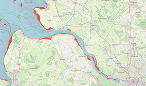
g2lab has develop a web-based visualization of sea level rise
simulations for Northern Germany.
more information
New Project!

g2lab participates in the joined project "ABM4Energy
- Alternative
bedding materials for the techno-ecological and economic optimization
of district heating pipeline construction", funded by the Federal
Ministry for Economics and Energy (BMWE)
more
information
MobiDoc

g2lab works on modeling, simulating and visualizing the
accessibility of medical facilities.
more
information
Maps in dark mode

g2lab has developed an online tool for selecting color
schemes
that are suitable for maps in dark mode.
more
information
Textbooks
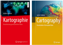
The textbooks Kartographie (in
German) and Cartography
(in English), written
by Jochen
Schiewe, describes the fundamentals of Cartography
more information
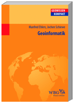
The textbook on "Geoinformatics" (in
German), written
by Jochen
Schiewe together with Manfred Ehlers (University of
Osnabrück), covers the basics of GI Science.
more information
In the media
Jochen Schiewe in a podcast of Hamburg Research Academy on the power of visualizations"The NDR reports from the project "Sea Level Map"
more media clips