Current projects
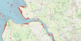
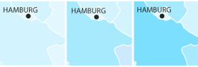
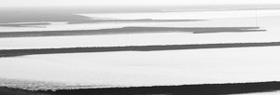
Sea Level Map
g2lab has develop a web-based visualization of sea level rise
simulations for Northern Germany.
more
information
Modelling and simulation of accessibility of medical facilities (unGESUND)
g2lab works on modeling and simulating accessibility of
medical facilities. Project partners
are the Universitätklinikum Eppendorf (UKE), Hochschule
für Angewandte Wissenschaften (HAW) and collegues from
HCU.
more
information
Current Ph.D. projects
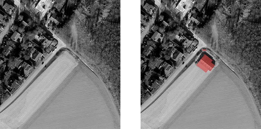
Object Based Change Detection using Machine Learning and Multi-source data (Güren Tan Dinga)
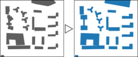
Deep Learning methods for cartographic generalization based on geographical vector data (Martin Knura)
Optimised Utilisation of Geospatial Data in Extended Reality Environments (Patrick Postert)
Finished projects
Partizipation: Kollaborativ und Multimedial (PaKOMM)
g2lab leads this project which concerned with the comination
of various visualization formats for public participation processes,
including Augmented and Virtual Reality applications. Project partners
are the City Science Lab (HCU) and the FTZ Digital Reality (HAW).
Funding is provided by the City of Hamburg.
more
information

0 CO2 Speicherstadt
g2lab is working on the development of usable Building
Information Models (BIM) in the context of a CO2
neutral operation of historical building in the Hamburg
Speicherstadt.
more
information
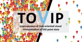
Improvement of task-oriented visual interpretation of VGI point data (TOVIP)
g2lab has received funding by the German Research Foundation
(DFG) for a
project on improving the visualization of point data derived from
Volunteered Geographic Information (VGI).
The project is embedded into the Priority Program "Volunteered
Geographic Information: Visualization - Interpretation - Social
Computing"
more
information

Flexible and demand-oriented provision, processing, and integration of climate and weather data for seamless business processes (FAIR)
g2lab has received funding by the German Federal Ministry of
Transport and Digital Infrastructure (BMVI) for a project within the
mFUND-program for the development of services related to open weather
data.
more
information
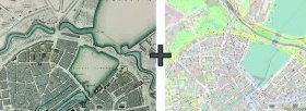
Development of a Semiological Methodology on the Comparability of Current with Historical Geodata (Inga Schlegel)
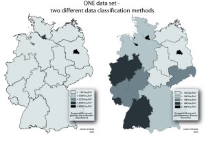
Task-oriented data classification for choropleth maps (aChor)
g2lab has received funding by the German Research Foundation
(DFG) for a
project on improving the task-oriented generation of choropleth maps.
The idea is to preserve spatial patterns like extreme values or hot
spots after the classification step.
more
information
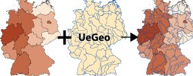
Overlay of Geodata (UeGeo)
g2lab has received funding by the German Federal Ministry of
Transport and Digital Infrastructure (BMVI) for a project within the
mFUND-program that enables the overlay of geodata with different
reference geometries.
more
information
Better decisions based on uncertain data (BEMUDA)
g2lab has received funding by the German Federal Ministry of
Transport and Digital Infrastructure (BMVI) for a project within the
mFUND-program that develops a concept and software tool for handling
uncertain data in typical sptio-temporal processes.
more
information

GEWISS - Geographical Heat Information and Simulation System Hamburg (GEografisches WärmeInformations- und Simulations-System Hamburg)
g2lab is involved in new research project funded by the
German
Ministry for Economic Affairs and Energy (BMWi) which aims at the
development of a Geographical Heat Information and Simulation System.
more
information
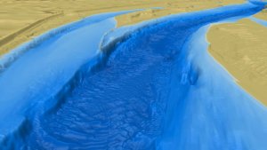
3D "Dive throughs" the Elbe
Together with the newspaper WELT g2lab has developed new views of the river Elbe, showing the riverbed in a couple of 3D interactive views and videos.more information
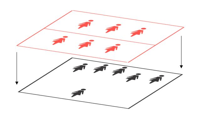
Combining data of different spatial granularity (CoGran)
g2lab has received funding by VolkswagenStiftung for the
project on
“Combining data of different spatial granularity
(CoGran)”
which will be conducted together with Julius Tröger (Berliner
Morgenpost).
more
information
Sound Maps for Encoding Quantitative Information
We aim at exploring possibilities to convey quantitative
information as sound. Hence we develop prototypes to compare classical
forms of presentation such as color and hachure with sound.
more
information
Geoinformation for the Coastal Zone
Development and processing of geoinformation for coastal
areas as well as implementation of spatial data infrastructures for a
sustainable and integrated management of coastal zones.
more
information

Analysis and Improvement of the User-Friendliness of Strategic Noise Maps for Public Participation (PhD project)
We aim at improving the user-friendliness of strategic noise
maps
and conducted qualitative, quantitative and requirements analyses to
evaluate aspects to be improved.
more
information
Uncertainty in Geovisual Analytics of Land Cover Change Processes (PhD project)
This project is concerned with the role of uncertainty during
analyses using Geovisual Analytics. Is uncertainty information
beneficial when it is visually communicated to the user during the
analysis? Can users get better insights with the use of uncertainty
information?
more
information

Adjustment of Map Colors for Users With Color Vision Deficiencies
Our research aims at the improvement of color schemes to make
them accessible to users with color vision deficiencies.
more
information

KLIWAS: Climate - Water - Navigation
Modeling and visualization of uncertainties in estuary
vegetation monitoring based on multi- and hyperspectral remotely sensed
data.
more
information

OptiLAP - Evaluation and Optimization of Noise Action Plans
Analysis of the visualization of noise used for public
participation and suggestions for the design of target group oriented
noise maps.
more
information

CLAIM - Classification Assessment Using an Integrated Method (funded by DFG)
Modeling of uncertainty introduced by classification of remote
sensing data (fuzzy model). Development of advanced quality assessment
measures based on the uncertainty model.
more
information