Uncertainty in Geovisual Analytics of Land Cover Change Processes (PhD project)
Uncertainty is inherent in spatio-temporal data, mainly stemming from measurement, processing and analysis. During the last decades much research has been done to describe, quantify and use uncertainty information, especially in the field of GIScience. One of the overall goals of this research is to enhance the analysis of spatiotemporal phenomena, e.g., predicted urban sprawl in urban planning or flooding scenarios in disaster management. However, practically usable models and methods for this purpose are still rare and the supposed positive effect of uncertainty information has not been researched in a systematic way.
This PhD project aims to enable uncertainty-aware analyses by following a (Geo-)Visual Analytics approach, i.e., to create workflows that integrate automated algorithms with interactive visual components to combine the strengths of algorithms and human reasoning. This approach shows great potential to effectively communicate uncertainty information to the user during analysis. The central question of this project is if users are able to benefit from uncertainty information when using a Geovisual Analytics tool: Does it change the hypotheses they make and the insights they gain?
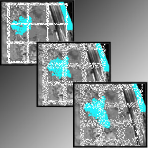
This work focuses on land cover changes analyses based on satellite image time series during which uncertainty plays an important role. A software prototype for uncertainty-aware change analysis (ICchange) is developed as proof-of-concept and for evaluation purposes. User studies are conducted in which experts analyze different real-data change scenarios provided with visually communicated uncertainty information. Results from these studies as well as from prototype development will be compiled in a framework to support tool development in practice.