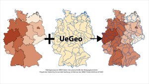
Overlay of BMVI geodata with different reference geometries (UeGeo)
A spatial
re‐organization (areal interpolation) of attribute data becomes
necessary when multiple
data sets are merged. However, these data sets are very often attached
to
different reporting zones. By using a simple area weighting approach
for
disaggregation purposes, significant over- and underestimation is a
recurring
problem. Therefore, ancillary weighting information such as additional
attributes or population distribution can be introduced into
corresponding interpolation
algorithms, assuming the user’s knowledge and understanding
of these
approaches. Expanding the research focus and software product generated
within
the project CoGran
(Combining data of
different spatial granularity) UeGeo
intends to further develop the implemented methods for spatial
reorganization.
The
project’s aim is to provide a detailed and validated concept
for an extended
toolbox to enhance usability and guide users in their endeavors.
The
applicable methods will be examined for their required input and
desired
outcome to give users task-oriented and data-based recommendations for
specific
purposes. Furthermore, comparison and assessment of computation results
will be
enabled by documenting and visualizing the associated uncertainties.
This
project is funded by the German Federal Ministry of Transport and
Digital
Infrastructure (BMVI). The mFUND-program promotes the scope of the
BMVI’s extensive
open source data research platform mCloud.
Likewise, UeGeo will be
made
available publicly/openly. Exemplarily employed data derived from
mCloud is
used to demonstrate UeGeo’s
applicability to provide users with highly useful services to gain new
insights
by intersecting different spatially overlapping data sets.