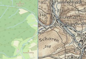
Automated georeferencing of historical maps
This PhD project aims to develop an automatic method to
georeference historical topographic maps. Georeferencing allows easier
access
and analysis of the troves of historical maps in state archives.
We
investigate the use of spatial information encoded in
the geometry of map symbols to precisely georeference maps in the image
domain.
To this
end, computer vision methods are adapted to the
special use case of maps. Specifically, map images are encoded with
feature
descriptors and correlated with volunteered geographic information by
content-based image retrieval.
This
project is funded in the sharing.city.college by the
City of Hamburg. The maps are kindly provided by the Specialised
Information
Service Cartography and Geodata at the Berlin
state library.
For more
information refer to first publications